This website uses cookies

We and authorised third parties use cookies. More information about the cookies, their purpose and how they are shared is explained fully in the cookies information. In order to guarantee the best possible user experience, please click "accept all". You can also save preferences or decline the use of cookies, with the exception of necessary cookies. Cookies information and more

168.Auktion


Strike a deal in the post-auction sale

Post-auction sale | Physical auction

7020

Lot: 7020

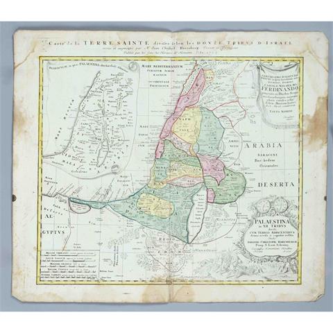
Historical map of the Holy Land

Starting price 80 EUR

Historical map of the Holy Land, ''Carte de la Terre Sainte divesée selon les douze tribus d'Israel'', with partial map of Palestine, figurative-ornamental cartouche and mileage indicator, partly colored copper engraving map by Homann Erben, 1750, centerfold, more stained in the margin, tear at lower fold, sheet dimensions 53 x 62 cm